


Geoelectric section
The section has been interpreted taking into account the available geological materials.
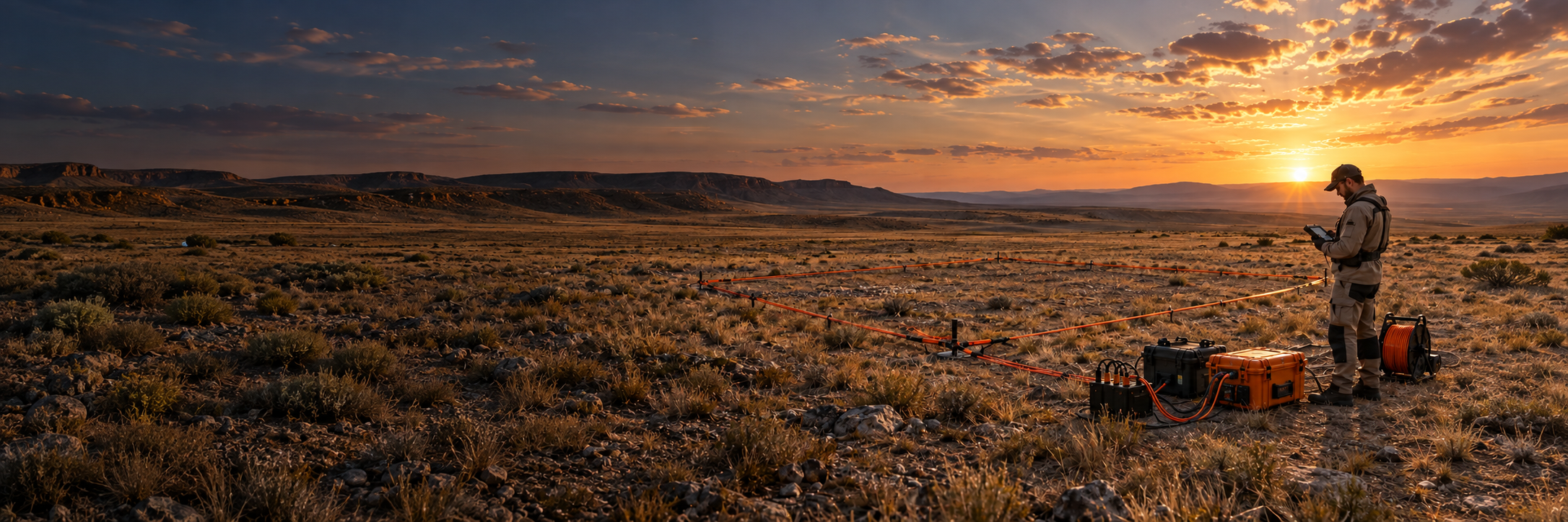
TEM/TDIP pulsed electrical exploration for studying conductive and polarizable objects, refining the structure of an area and planning further exploration.
Discuss your projectThe transient electromagnetic method (TEM), with time-domain induced polarization (TDIP) where required, records the response of the ground after the transmitter current is switched off. It helps investigate conductive and polarizable targets.
TEM/TDIP surveys are sensitive to conductive and polarizable targets at different depths. They help locate ore bodies associated with sulfides or graphite and clarify the geological structure of a site.
SMART GEOPHYSICS provides a complete TEM/TDIP survey service: survey design, field measurements, data processing, interpretation and a final technical report.
We select the transmitter-loop configuration, measurement parameters, and network density based on the geological task, site area, topography, and required exploration depth.
Identification of zones of low resistance associated with sulphide mineralization.
Detection of disseminated mineralization by polarizability anomalies.
Thickness of cover deposits, position of ore bodies, faults and contacts.
Justification of borehole locations based on geoelectric sections.
TEM/TDIP results are compared with geology, geochemistry, magnetic exploration and drilling data.
More about the method: electrical exploration and IP
Identification of promising conductive and polarizable zones at an early stage of research.
Clarification of the geometry and spatial position of anomalies in selected areas.
Comparison of electromagnetic data with geological structure and other types of information.
Ranking of targets and justification of directions for subsequent detailed work and drilling.
The mobile field system includes a transmitter, receiver, cables and a transmitter loop. The configuration is tailored to the task and site conditions.
| Method | TEM/TDIP — pulsed electrical prospecting |
| Complex | Transmitter, receiver, cables and loop |
| Work plan | Profile or area survey |
| Parameters | Selected based on the geological task and site conditions |
| Quality control | Checking the completeness and stability of measurements in the field |
The transmitter-loop size, the observation network, the volume and timing of the work are determined after analyzing the site, source materials and requirements for the result.

The section has been interpreted taking into account the available geological materials.
Time response curves with logarithmic axes for observation points.
Distribution of conductivity at different depths to identify conductive zones in an area.
Methodology, results, conclusions and recommendations for the next stage of the research.
If the data already exists: processing and interpretation of geophysical data
SMART GEOPHYSICS performs multi-site surveys and comprehensive geophysical research in Kazakhstan. For each site, the work program is selected based on the geological objective, site accessibility, initial data, and final product requirements. Specific projects are published only upon client approval.











TEM/TDIP helps identify conductive and polarizable targets, estimate their positions and refine the geoelectric model of the site. We interpret results alongside geological and drilling data.
The method is used to locate ore bodies and mineralized zones, refine the geological section, investigate anomalies and plan further exploration and drilling.
Transmitter-loop size, instrument settings, rock conductivity, noise levels and site conditions. We estimate the depth of investigation for the specific survey program.
The geological objective, site boundaries, existing maps, sections and drilling data, plus the desired investigation depth and delivery format. We can help define missing parameters.
Field and processed data, transient-decay curves, maps and geoelectric sections, interpretation, and a technical report with recommendations. Deliverables are agreed in the scope of work.
Yes. TEM/TDIP can be combined with electrical resistivity and IP surveys, magnetic surveying, geochemistry and borehole geophysics for more reliable interpretation.
The site area and terrain, survey-grid density, loop configuration, accessibility, noise levels and processing scope. We prepare a work plan and estimate after reviewing the available data.
Tell us about the geological task, the site, and the available materials. SMART GEOPHYSICS specialists will suggest a project configuration, the scope of the deliverables, and the next steps in the exploration.


